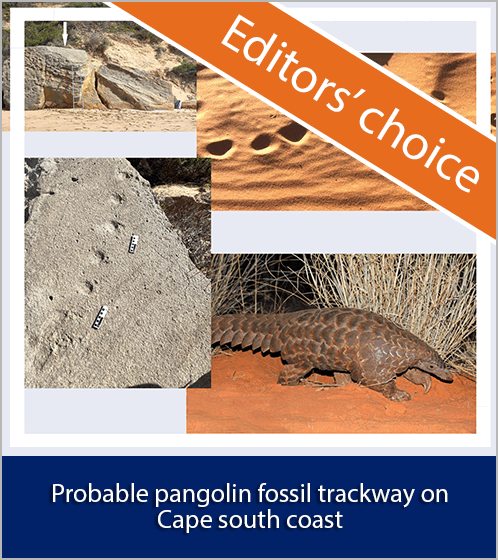
System description of the mobile LIDAR of the CSIR, South Africa
Abstract
South Africa's first mobile LIDAR (LIght Detection And Ranging)system is being developed at the National Laser Centre (NLC) of the
Council for Scientific and Industrial Research (CSIR) in Pretoria
(25°45'S; 28°17'E). The system is designed primarily for remote
sensing of the atmosphere. At present, the system is being optimised
for measuring vertical atmospheric backscatter profiles of aerosols
and clouds. In this paper, we describe the complete LIDAR system,
including laser transmission, telescope configuration, data acquisition,
data archival and post-processing.
Downloads
Published
2010-02-02
Issue
Section
Research Articles
License

All articles are published under a Creative Commons Attribution 4.0 International Licence
Copyright is retained by the authors. Readers are welcome to reproduce, share and adapt the content without permission provided the source is attributed.
Disclaimer: The publisher and editors accept no responsibility for statements made by the authors
How to Cite
Sharma, A., Sivakumar, V., Bollig, C., van der Westhuizen, C., & Moema, D. (2010). System description of the mobile LIDAR of the CSIR, South Africa. South African Journal of Science, 105(11/12), 456-462. https://sajs.co.za/article/view/10230
Views
- Abstract 173
- PDF 105